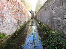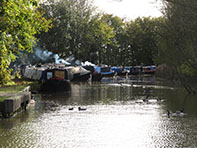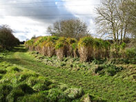
There's no bridge, so to gain access to the arm you have to cross Cosgrove Lock. There is then a line of moored boats, some frankly have seen better days, to where the navigation currently ends at Cosgrove Bridge 1. An attractive countryside stroll then ensues, along a good towpath for the first 100 yards or so. The canal is in water but like the towpath slowly deteriorates and, after a second farm track blocks it completely, the canal all but disappears. After Bridge 2 which has ongoing restoration work, the canal bed is easy to follow. There's a sluice gate to remind you that this was once in water but then a mass of brambles take over and this section of the canal ends just over a mile from Cosgrove at the A5.
On the other side of the A5, remnants of the canal can still be found and its path traced but much of it has been built over and it then traverses private land, so the walker has to get to, by whatever means, the A422 - Thornton road at Grid Reference SP 74991 36513, about 3½ miles away as the crow flies. Look out for the Ouse Valley Walk sign post on the right before reaching Thornton College. This well marked path will follow the original canal line to Buckingham.
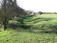
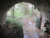
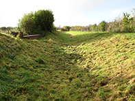
In parts this is not an easy path as it becomes very narrow and you'll have to contend with overgrown bushes and trees that are about to fall or have fallen blocking your way. This is immediately apparent as you clamber down from the lane to reach the remains of Thornton Bridge 18, near to what was Thornton Wharf. You quickly climb a stile and the empty canal bed is clear to see. Continue along the bed until reaching a fence, climb a stile and the canal is still visible but overgrown and after negotiating nettles and brambles the path meets the A422 and there is only one winner. The canal would have been carried over Cattleford Bridge here but you now have to walk a few yards along the side of this busy road before the path returns into a line of trees with the canal still apparent for a short distance. However, following the footpath over fields through a series of stiles and gates, it is hard to believe that there was once a canal here.
You will eventually walk round the side of the modern buildings that now occupy what was Leckhamstead Wharf and on the far side of the lane rejoin what is clearly a canal bed signposted 'Buckingham Canal & Nature Reserve'. The canal and path become increasingly overgrown but suddenly the restored Lock 1 (Hyde Lane) appears. There's new hedging and the path improves for a short distance as you make your way through the nature reserve with a reservoir on the far side. From where the reserve ends, if you didn't know there was once a canal present, you would never guess it. But alternatively, if you are aware of the former canal, it is fairly easy to follow its path along the field edges until Old Mill House.
There is no sign of the canal or the wharf that served Maids Moreton Mill but continue to follow the Ouse Valley Walk as it goes round the edge of a wood which the canal would have gone straight through before co-existing with the River Ouse for 150 yards. As it bends, the footpath now distances itself from the river, as did the canal, until you reach the site of Bourton Lock at a distinctive white house. After walking to the side of the house, the canal magically reappears, it's been restored, is in water with a good towpath until finishing just before the A413. Dedicated canal hunters may well then cross the road and follow the Oase Valley Way as it follows much of the canal into Buckingham where it terminated at Town Wharf which is now a small business estate.
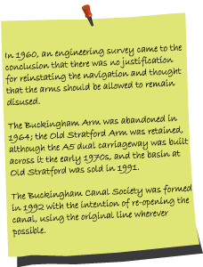
The Buckingham Canal Society has a tough job on their hands restoring this canal, much of which has disappeared from view, they can be reached via www.buckinghamcanal.org.uk and have work parties throughout the year.
View Buckingham Arm in a larger map